
Elevated Fire Danger as Strong Winds Return to PNW on Sunday & Monday
Strong winds make a return to Washington and Oregon with a dry trough moving through the area. It's a double threat this weekend as Geomagnetic storm conditions have reached G4 (SEVERE) levels.

The winds will be an issue Sunday into Monday.

Fire spread concerns will be elevated, as always this time of year. Wind gusts are expected to exceed 35 mph at times. If a wind advisory is issued, you may need to postpone your plans or be prepared to move activities inside.
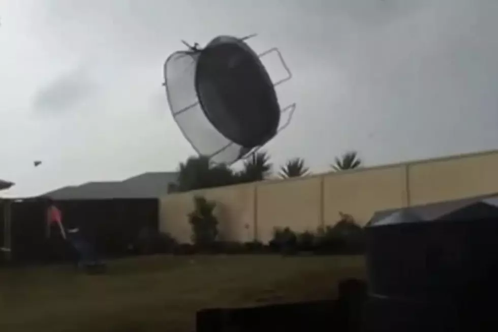
Residents should secure belongings, such as garbage cans, outdoor furniture, and of course, the trampoline. Bring in unsecured objects from patios and balconies.

If you are driving in high winds, the National Weather Service recommends:

• Keep both hands on the wheel and slow down.
• Watch for objects blowing across the roadway and into your path.
• Keep a safe distance from cars in adjacent lanes as strong gusts could push a car outside its lane of travel.
• Take extra care in a high-profile vehicle such as a truck, van, SUV, or when towing a trailer, as these are more prone to be pushed or even flipped by high wind gusts.
• If winds are severe enough to prevent safe driving, get onto the shoulder of the road and stop, making sure you are away from trees or other tall objects that could fall onto your vehicle. Stay in the car and turn on the hazard lights until the wind subsides.
TIPS: Here's how you can prepare for power outages
LOOK: The most extreme temperatures in the history of every state
Gallery Credit: Anuradha Varanasi
KEEP READING: Get answers to 51 of the most frequently asked weather questions...
More From 102.7 KORD


![Moses Lake Corporal Drove Ahead of the Chase and Made the Tackle [VIDEO]](https://townsquare.media/site/112/files/2026/07/attachment-moses-lake-police-department-2.png?w=980&q=75)


